File:Republic-of-Otrantiana.png
Jump to navigation
Jump to search


Size of this preview: 698 × 599 pixels. Other resolution: 1,112 × 955 pixels.
Original file (1,112 × 955 pixels, file size: 192 KB, MIME type: image/png)
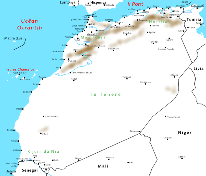
Map of the Republic of Otrantiana, the alt-Earth area where Atlantic is spoken, corresponding to real-world Morocco, Western Sahara, and parts of Mauritania, Mali, Algeria, and Spain (the Canary Islands).
File history
Click on a date/time to view the file as it appeared at that time.
| Date/Time | Thumbnail | Dimensions | User | Comment | |
|---|---|---|---|---|---|
| current | 20:28, 2 July 2020 | | 1,112 × 955 (192 KB) | Lili21 (talk | contribs) | New image with minor conworld changes |
| 14:03, 20 April 2019 | 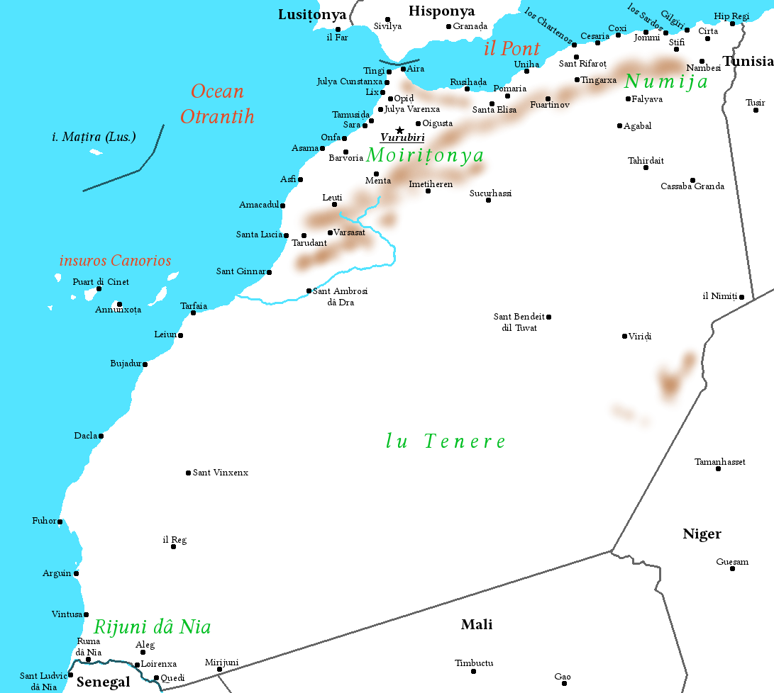 | 1,091 × 978 (184 KB) | Lili21 (talk | contribs) | Map of the Republic of Otrantiana, the alt-Earth area where Atlantic is spoken, corresponding to real-world Morocco, Western Sahara, and parts of Mauritania, Mali, Algeria, and Spain (the Canary Islands). |
You cannot overwrite this file.
File usage
The following page uses this file: