File:Continents of Calémere.png
Jump to navigation
Jump to search


Size of this preview: 781 × 600 pixels. Other resolution: 1,289 × 990 pixels.
Original file (1,289 × 990 pixels, file size: 319 KB, MIME type: image/png)
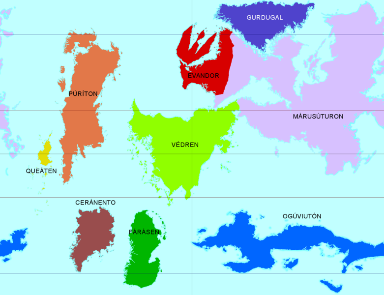
Map of Calémere showing its continents. The border between Evandor and Márusúturon follows the common definition used by Ceria and Nordulik amongst others.
The map is longitudinally centered on the meridian of Mánébodin, capital of Ceria, used as the prime meridian in the Western (Evandorian) longitude system. The circles of latitude shown are the polar circles (65° 45′ 21.6″), the tropics (24° 14′ 38.4″), and the Equator.
File history
Click on a date/time to view the file as it appeared at that time.
| Date/Time | Thumbnail | Dimensions | User | Comment | |
|---|---|---|---|---|---|
| current | 21:00, 2 October 2017 | | 1,289 × 990 (319 KB) | Lili21 (talk | contribs) | Map of Calémere showing its continents. The border between Evandor and Márusúturon follows the common definition used by Ceria and Nordulik amongst others. The map is longitudinally centered on the meridian of Mánébodin, capit... |
You cannot overwrite this file.
File usage
There are no pages that use this file.