File:Inquisition-tribunals-dioceses.png
Jump to navigation
Jump to search

Size of this preview: 800 × 524 pixels. Other resolutions: 2,560 × 1,676 pixels | 3,348 × 2,192 pixels.
Original file (3,348 × 2,192 pixels, file size: 901 KB, MIME type: image/png)
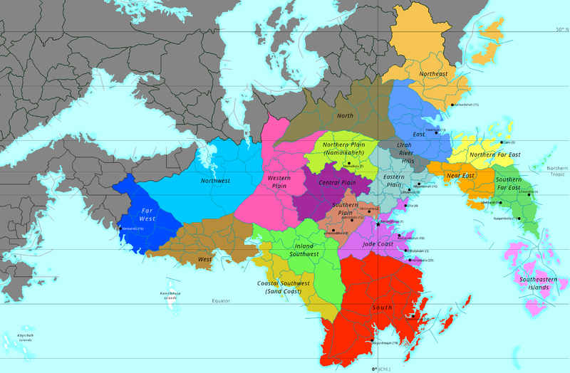
Political map of the Chlouvānem Inquisition with tribunals (coloured) and borders of dioceses.
File history
Click on a date/time to view the file as it appeared at that time.
| Date/Time | Thumbnail | Dimensions | User | Comment | |
|---|---|---|---|---|---|
| current | 16:16, 15 November 2020 | | 3,348 × 2,192 (901 KB) | Lili21 (talk | contribs) | Various conworld changes; more details added |
| 15:04, 26 December 2017 |  | 2,100 × 1,379 (693 KB) | Lili21 (talk | contribs) | Various border changes | |
| 11:08, 20 June 2017 | 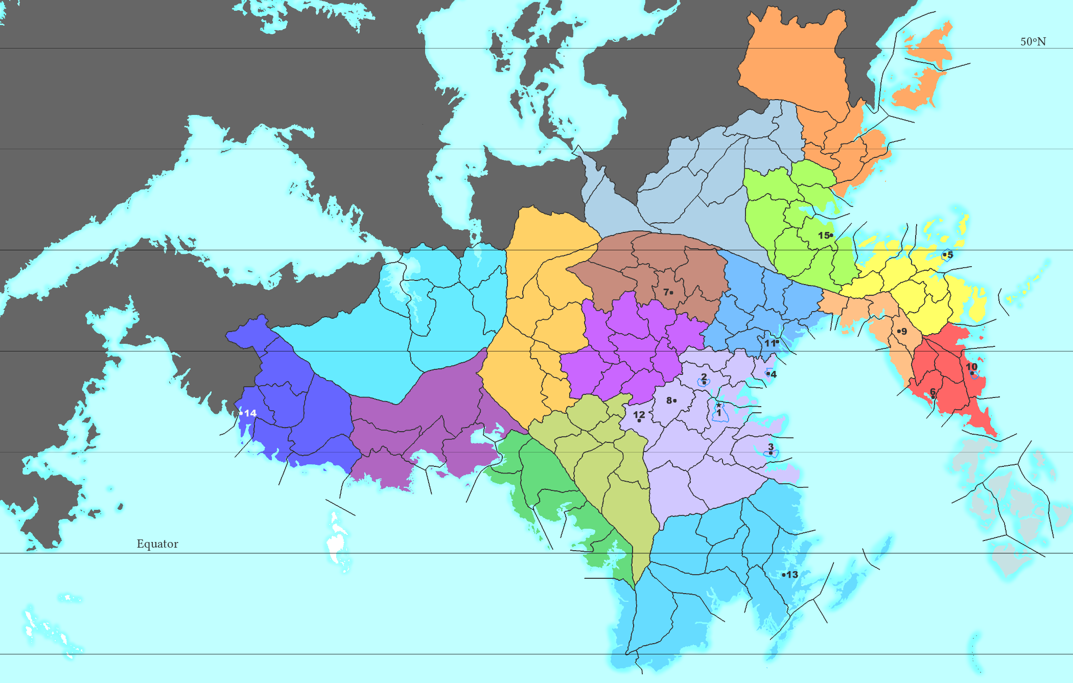 | 2,100 × 1,337 (679 KB) | Lili21 (talk | contribs) | ||
| 10:30, 26 March 2017 |  | 2,000 × 1,299 (772 KB) | Lili21 (talk | contribs) | Major conworld changes | |
| 20:01, 26 February 2017 |  | 2,000 × 1,290 (570 KB) | Lili21 (talk | contribs) | Border changes | |
| 20:53, 9 February 2017 | 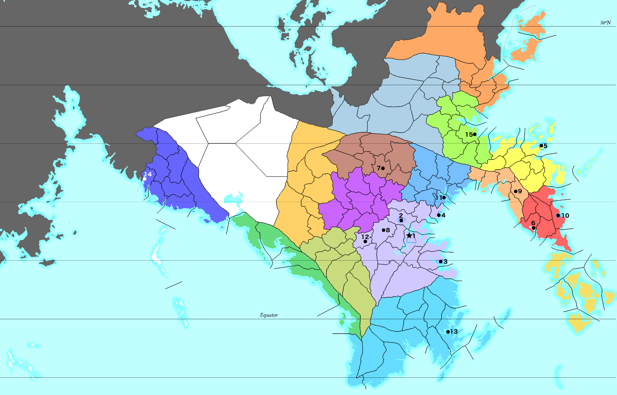 | 2,000 × 1,281 (581 KB) | Lili21 (talk | contribs) | Political map of the Chlouvānem Inquisition with tribunals (coloured) and borders of dioceses. |
You cannot overwrite this file.
File usage
The following page uses this file: