File:GwaxolMap.png
No higher resolution available.
GwaxolMap.png (400 × 400 pixels, file size: 48 KB, MIME type: image/png)
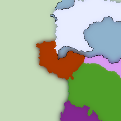
Range map of Gwaxol (brown), Kelajw (white), 'Oa (pink), and Thuosha' (purple)
File history
Click on a date/time to view the file as it appeared at that time.
| Date/Time | Thumbnail | Dimensions | User | Comment | |
|---|---|---|---|---|---|
| current | 06:38, 22 July 2023 | | 400 × 400 (48 KB) | Dillon (talk | contribs) | Added Ku Te Kui |
| 07:03, 3 June 2023 |  | 400 × 400 (52 KB) | Dillon (talk | contribs) |
You cannot overwrite this file.
File usage
The following page uses this file: