Uploads by Lili21
This special page shows all uploaded files.
| Date | Name | Thumbnail | Size | Description | Versions |
|---|---|---|---|---|---|
| 22:45, 7 March 2022 | DarLifasyam-flag.png (file) |  |
9 KB | New flag. | 3 |
| 11:57, 25 April 2021 | Lifashian alphabet.png (file) |  |
67 KB | Revised version. | 2 |
| 13:15, 27 February 2021 | LifashianSSR-Flag.png (file) |  |
31 KB | 2 | |
| 18:59, 22 December 2020 | Inquisition-high-speed-rail.png (file) |  |
861 KB | More changes | 4 |
| 09:03, 16 November 2020 | Inquisition-time-zones.png (file) |  |
753 KB | Updated version | 3 |
| 16:16, 15 November 2020 | Inquisition-tribunals-dioceses.png (file) |  |
901 KB | Various conworld changes; more details added | 6 |
| 09:53, 29 July 2020 | Qualdomailor.png (file) |  |
216 KB | Map of the country of Qualdomailor (''Cwaldewmăjlor''), a sovereign state on Verse:Calémere. | 1 |
| 20:28, 2 July 2020 | Republic-of-Otrantiana.png (file) |  |
192 KB | New image with minor conworld changes | 2 |
| 15:06, 29 April 2020 | Evandorian languages in Evandor.png (file) |  |
239 KB | Major update | 2 |
| 11:17, 28 January 2020 | Flag of Ceria.png (file) |  |
8 KB | New colours | 2 |
| 21:15, 31 July 2019 | Lahob languages.png (file) |  |
559 KB | Map updated | 2 |
| 18:41, 27 January 2019 | Tameï-flag.png (file) |  |
7 KB | The flag (since December 11, 1999) of the Tameïan People's Socialist Republic, a fictional island country in the Indian Ocean. The nine points on each star represent the nine major islands, where most of the population lives and where the 1934 Revolut... | 1 |
| 18:38, 27 January 2019 | Tamei-Islands.png (file) |  |
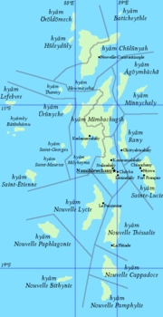
89 KB | The '''Tameï Islands''' (''hyâmõy Tameïchey'' {{IPA|[xjɑmɤ͡ɘɨ̯ tʲæmʲe̘ˈi̘ːɕɘ͡ee̝̯]}}), a fictional country on Earth where Tameï is spoken. | 1 |
| 12:58, 12 August 2018 | Bronosphere.png (file) |  |
159 KB | Map of the Brono-Fathanic-speaking area on Verse:Calémere, consisting of the two independent countries Brono and Fathan and of the Chlouvānem diocese of Hivampaida. | 1 |
| 10:14, 1 April 2018 | Flag of Skyrdagor.png (file) |  |
4 KB | The flag of the Republic of Skyrdagor. | 1 |
| 22:55, 4 March 2018 | Sacred Emblem of the Inquisition.png (file) |  |
56 KB | 2 | |
| 18:14, 4 March 2018 | Flag of Qualdomailor.png (file) |  |
26 KB | Flag of the Communist Republic of Qualdomailor, first adopted in 37Ɛ4 <small>(6328<sub>10</sub>)</small>. The flag combines red and blue - two colours historically connected to the country, the latter in a particular light... | 1 |
| 16:31, 4 March 2018 | Flag of the Inquisition.png (file) |  |
40 KB | Flag of the Verse:Chlouvānem Inquisition, adopted in 37Ɛ5 <small>(6329<sub>10</sub>)</small> during the Kaiṣamā era, combining Calémerian Yunyalīlti w:Socialist heraldry with the traditional emblem of the Inquisition (the black hand on... | 1 |
| 17:19, 11 February 2018 | Greater-Skyrdagor.png (file) |  |
168 KB | A map illustrating the countries of Greater Skyrdagor (Skyrdagor: ''gilyjlydh Skyrdagor'' [ɟ͡ʝiɮʊɪ̯ɮɯð ɧɯ˞dɒː˞]) and their position inside Márusúturon. Ogotet'hep is shaded because about 38% of its population is ethnically Skyrdeg... | 1 |
| 16:24, 7 February 2018 | Chlouvānem-script-parts.png (file) |  |
41 KB | Conlang and conscript update | 2 |
| 21:00, 2 October 2017 | Continents of Calémere.png (file) |  |
319 KB | Map of Calémere showing its continents. The border between Evandor and Márusúturon follows the common definition used by Ceria and Nordulik amongst others. The map is longitudinally centered on the meridian of Mánébodin, capit... | 1 |